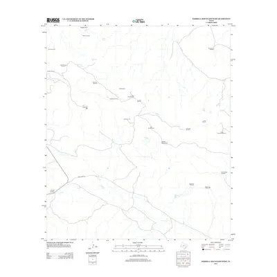
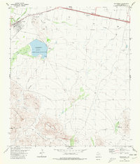
2012 Map of Barrilla Mountains West
USGS Topo · Published 2012About this map
The Barrilla Mountains define this high-desert landscape in Jeff Davis County, where water is the primary driver of human infrastructure. This 2012 survey illustrates a rugged ranching territory dominated by a network of family-named windmills and tanks, essential for livestock in an arid environment. Named landmarks like Carpenter Mtn and Needle Point tower over the drainage systems of Limpia Cr, which carves through the prominent Limpia Canyon. The distribution of features such as the McCamey Windmill, Hernandez Windmill, and Carpenter Goat Tank suggests a history of carefully managed land use and water rights. Transportation is limited to remote thoroughfares like Limpia Creek Rd, which follows the natural contours of the canyon floors. Researchers and local historians can trace these water-source sites to understand the grazing patterns and land divisions of this West Texas range.
Find a feature on this map
34 named features on this map. Tap any name to fly to it.
Don’t see what you’re looking for? This feature index may not catch every label — zoom into the map to look around manually.
Map Details
Editions of this 2012 Barrilla Mountains West Map
This is the sole edition of this map. No revisions or reprints were ever made.
Other maps of this area

1894 · Fort Davis
USGS Topo · 1:125,000

1897 · Fort Davis
USGS Topo · 1:125,000

1954 · Fort Stockton
USGS Topo · 1:250,000

1958 · Fort Stockton
USGS Topo · 1:250,000

1972 · Swayback Mountain
USGS Topo · 1:24,000
1972 · Big Aguja Mountain
USGS Topo · 1:24,000
1972 · Toyahvale
USGS Topo · 1:24,000

1973 · Fort Stockton
USGS Topo · 1:250,000
1980 · Cox Draw
USGS Topo · 1:24,000
1980 · Balmorhea
USGS Topo · 1:24,000