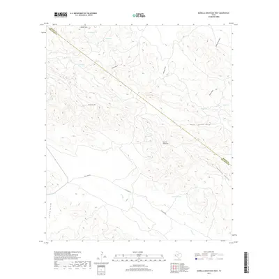
2019 Map of Barrilla Mountains West
USGS Topo · Published 2019About this map
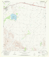
Barrilla Mountains dominate this high-desert landscape in Jeff Davis County, where the terrain is defined by deep drainages and volcanic peaks. The topography is anchored by Carpenter Mtn and the prominent Needle Point, with water sources being the primary indicators of historical land use in this arid region. The map tracks several critical water points essential for ranching and survival, including House Spring, Apple Spring, and Head Spring. The presence of Carpenter Goat Tank and Shewmake Tank highlights the modification of the land for livestock, while the Dry Lake basin suggests the seasonal nature of water availability. To the south, Limpia Creek Rd follows the winding course of Limpia Cr through its namesake canyon, providing the main artery through this remote section of the Trans-Pecos near the Reeves County line.
Find a feature on this map
23 named features on this map. Tap any name to fly to it.
Don’t see what you’re looking for? This feature index may not catch every label — zoom into the map to look around manually.
Map Details
Editions of this 2019 Barrilla Mountains West Map
This is the sole edition of this map. No revisions or reprints were ever made.
Other maps of this area

1894 · Fort Davis
USGS Topo · 1:125,000

1897 · Fort Davis
USGS Topo · 1:125,000

1954 · Fort Stockton
USGS Topo · 1:250,000

1958 · Fort Stockton
USGS Topo · 1:250,000

1972 · Swayback Mountain
USGS Topo · 1:24,000
1972 · Big Aguja Mountain
USGS Topo · 1:24,000
1972 · Toyahvale
USGS Topo · 1:24,000

1973 · Fort Stockton
USGS Topo · 1:250,000
1980 · Cox Draw
USGS Topo · 1:24,000
1980 · Balmorhea
USGS Topo · 1:24,000