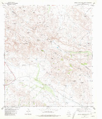
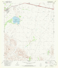
1980 Map of Barrilla Mountains West
USGS Topo · Published 1981About this map
The Barrilla Mountains dominate this high-desert landscape in Jeff Davis and Reeves Counties, characterized by a complex network of springs, windmills, and canyons. Ranching infrastructure is exceptionally dense here, evidenced by numerous water features like the Carpenter Goat Windmill, Hernandez Windmill, and Shewmake Windmill. These names suggest a legacy of local land use and family-managed holdings during the late twentieth century.
Find a feature on this map
47 named features on this map. Tap any name to fly to it.
Don’t see what you’re looking for? This feature index may not catch every label — zoom into the map to look around manually.
Map Details
Editions of this 1980 Barrilla Mountains West Map
This is the sole edition of this map. No revisions or reprints were ever made.
Other maps of this area

1894 · Fort Davis
USGS Topo · 1:125,000

1897 · Fort Davis
USGS Topo · 1:125,000

1954 · Fort Stockton
USGS Topo · 1:250,000

1958 · Fort Stockton
USGS Topo · 1:250,000

1972 · Swayback Mountain
USGS Topo · 1:24,000
1972 · Big Aguja Mountain
USGS Topo · 1:24,000
1972 · Toyahvale
USGS Topo · 1:24,000

1973 · Fort Stockton
USGS Topo · 1:250,000
1980 · Cox Draw
USGS Topo · 1:24,000
1980 · Balmorhea
USGS Topo · 1:24,000