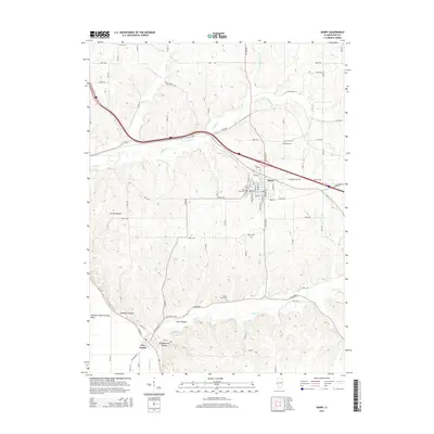
2015 Map of Barry
USGS Topo · Published 2015About this map
The town of Barry sits at the intersection of local commerce and modern transit, situated where rural township roads meet the Interstate corridor. This landscape in Pike County is defined by a dense network of drainage and hollows, including Grubb Hollow and Whippoorwill Hollow, which feed into major watercourses like Hadley Cr and Kiser Cr. A strong sense of local heritage is evident in the numerous burial grounds scattered across the township, from the central Barry Cem and Park Lawn Cem to more remote sites such as Woodruff Cem and Shearer Cem. Near the southwestern corner, the settlement of New Canton marks the transition toward the lowlands near the Shewhart-Gard Settling Basin. Between these communities, the land is dotted with natural features like Weber Spring and Jennings Spring, which historically influenced the placement of early farmsteads and rural roads.
Find a feature on this map
79 named features on this map. Tap any name to fly to it.
Don’t see what you’re looking for? This feature index may not catch every label — zoom into the map to look around manually.
Map Details
Editions of this 2015 Barry Map
This is the sole edition of this map. No revisions or reprints were ever made.
Other maps of this area

1925 · Liberty
USGS Topo · 1:62,500

1926 · Pittsfield
USGS Topo · 1:62,500

1926 · Mt Sterling
USGS Topo · 1:62,500

1927 · Liberty
USGS Topo · 1:62,500

1929 · Mt Sterling
USGS Topo · 1:62,500

1931 · Barry
USGS Topo · 1:62,500

1936 · Barry
USGS Topo · 1:48,000

1944 · Barry
USGS Topo · 1:62,500

1948 · Quincy
USGS Topo · 1:250,000

1956 · Quincy
USGS Topo · 1:250,000