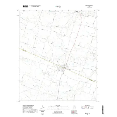
2019 Map of Bartlett
USGS Topo · Published 2019About this map
Bartlett sits at the heart of this landscape, straddling the border of Bell Co and Williamson Co. The town's grid is well-defined by historical corridors like W Davilla St and Elm St, with the surrounding countryside transitioning into a series of creek drainages including Donahoe Cr and Town Br. The area is notably dense with family-named landmarks and rural burial sites, such as Roucker Cem and Stockton Cem, which offer significant value for genealogical research into the region's early settlers.
Find a feature on this map
66 named features on this map. Tap any name to fly to it.
Don’t see what you’re looking for? This feature index may not catch every label — zoom into the map to look around manually.
Map Details
Editions of this 2019 Bartlett Map
This is the sole edition of this map. No revisions or reprints were ever made.
Other maps of this area

1885 · Taylor
USGS Topo · 1:125,000

1887 · Taylor
USGS Topo · 1:125,000

1893 · Georgetown
USGS Topo · 1:125,000

1894 · Taylor
USGS Topo · 1:125,000

1928 · Round Rock
USGS Topo · 1:62,500

1949 · Round Rock
USGS Topo · 1:62,500

1951 · Round Rock
USGS Topo · 1:62,500

1954 · Austin
USGS Topo · 1:250,000

1963 · Friendship
USGS Topo · 1:24,000
1963 · Davilla
USGS Topo · 1:24,000