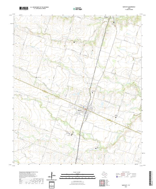
2022 Map of Bartlett
USGS Topo · Published 2022About this map
Bartlett straddles the boundary between Bell and Williamson Counties, serving as a central hub for a landscape defined by agricultural tradition and diverse immigrant heritage. This modern survey reveals a dense concentration of burial grounds that testify to the area's social history, including the Czech National Cem, German Methodist Cem, and the Old Black Cem. These sites, along with the Saint John Lutheran Cem, reflect the ethnic and cultural threads that established the community.
Find a feature on this map
80 named features on this map. Tap any name to fly to it.
Don’t see what you’re looking for? This feature index may not catch every label — zoom into the map to look around manually.
Map Details
Editions of this 2022 Bartlett Map
This is the sole edition of this map. No revisions or reprints were ever made.
Other maps of this area

1885 · Taylor
USGS Topo · 1:125,000

1887 · Taylor
USGS Topo · 1:125,000

1893 · Georgetown
USGS Topo · 1:125,000

1894 · Taylor
USGS Topo · 1:125,000

1928 · Round Rock
USGS Topo · 1:62,500

1949 · Round Rock
USGS Topo · 1:62,500

1951 · Round Rock
USGS Topo · 1:62,500

1954 · Austin
USGS Topo · 1:250,000

1963 · Friendship
USGS Topo · 1:24,000
1963 · Davilla
USGS Topo · 1:24,000