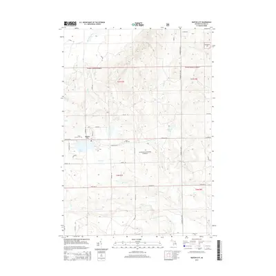
2014 Map of Barton City
USGS Topo · Published 2014About this map
Barton City anchors this portion of Alcona County, situated just north of the expansive Jewell Lake. The landscape is defined by the dense woodlands of the Huron National Forest and a complex network of waterways, including the West Br Pine River and Backus Cr. Significant local landmarks for historical research include the Trinity Lutheran Cem near the town center and Maple Ridge Cem located further east. The area’s geography is shaped by numerous small lakes such as Potter Lake and Maynard Lake, with drainage provided by Comstock Cr and the West Branch River. State Hwy 72 serves as the primary east-west corridor, cutting through the forest and connecting the scattered residential and recreational clearings that define this northern Michigan terrain.
Find a feature on this map
44 named features on this map. Tap any name to fly to it.
Don’t see what you’re looking for? This feature index may not catch every label — zoom into the map to look around manually.
Map Details
Editions of this 2014 Barton City Map
This is the sole edition of this map. No revisions or reprints were ever made.
Other maps of this area

1954 · Tawas City
USGS Topo · 1:250,000

1958 · Tawas City
USGS Topo · 1:250,000

1959 · Glennie
USGS Topo · 1:62,500

1959 · Harrisville
USGS Topo · 1:62,500

1971 · Spruce
USGS Topo · 1:24,000

1972 · Hubbard Lake
USGS Topo · 1:24,000

1972 · Hubbard Lake SW
USGS Topo · 1:24,000

1983 · Hubbard Lake
USGS Topo · 1:100,000
1989 · Barton City
USGS Topo · 1:24,000

1989 · Mikado
USGS Topo · 1:24,000