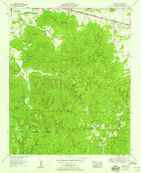
1953 Map of Barton
USGS Topo · Published 1986About this map
Barton sits along the Southern railroad line and Lee Highway at the northern edge of this Colbert County survey. The landscape transitions sharply from the transport corridor into the dense drainages of Sand Mountain Ridge and Wildcat Mountain. Central to the map is the Mountain Mills Lookout Tower, standing watch over a network of hollows such as Bugg Mill Hollow and Stillhouse Hollow. These valleys hide numerous family and community landmarks, including the McCais Cem and McLemore Cem, reflecting the area's ancestral settlement patterns before large-scale conservation efforts.
Find a feature on this map
59 named features on this map. Tap any name to fly to it.
Don’t see what you’re looking for? This feature index may not catch every label — zoom into the map to look around manually.
Map Details
Editions of this 1953 Barton Map
4 editions found
Other maps of this area

1911 · Iuka
USGS Topo · 1:48,000

1914 · Iuka
USGS Topo · 1:62,500

1924 · Gravelly Springs
USGS Topo · 1:48,000

1925 · Barton
USGS Topo · 1:62,500

1926 · Barton
USGS Topo · 1:48,000

1926 · Gravelly Springs
USGS Topo · 1:62,500

1929 · Barton
USGS Topo · 1:62,500

1935 · Cherokee
USGS Topo · 1:24,000

1935 · Pleasant Site
USGS Topo · 1:24,000

1936 · Margerum
USGS Topo · 1:24,000