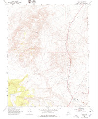
1967 Map of Basalt
USGS Topo · Published 1979About this map
Basalt stands as a focal point in this high-desert mining landscape of Mineral County, Nevada, as it appeared in the late 1960s. The settlement is positioned near a Landing Strip and serves as a junction where the industrial past meets the mid-century transportation network. The dominant physical legacy is the Old Railroad Grade, which carves a long path through the Candelaria Hills, signaling the area's historical reliance on rail for mineral extraction. Resource extraction remains a primary theme across the terrain, evidenced by the Eastside Mine, Noguez Mine, and scattered operations including a Mine Dump and several gravel pits. These features, along with isolated infrastructure like a Well and various water tanks, illustrate the sparse but deliberate development of a landscape shaped entirely by its geological wealth and the logistics required to move it.
Find a feature on this map
38 named features on this map. Tap any name to fly to it.
Don’t see what you’re looking for? This feature index may not catch every label — zoom into the map to look around manually.
Map Details
Editions of this 1967 Basalt Map
4 editions found
Other maps of this area

1909 · Hawthorne
USGS Topo · 1:250,000

1911 · Hawthorne
USGS Topo · 1:250,000

1915 · Hawthorne
USGS Topo · 1:250,000

1917 · White Mountain
USGS Topo · 1:125,000

1947 · Mariposa
USGS Topo · 1:250,000

1948 · Walker Lake
USGS Topo · 1:250,000

1948 · Mariposa
USGS Topo · 1:250,000

1957 · Walker Lake
USGS Topo · 1:250,000

1957 · Mariposa
USGS Topo · 1:250,000

1962 · Walker Lake
USGS Topo · 1:250,000