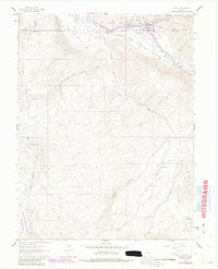
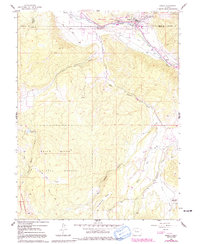
1961 Map of Basalt
USGS Topo · Published 1988About this map
The confluence of the Roaring Fork River and Fryingpan River anchors this mapping of the Roaring Fork Valley, where the Denver and Rio Grande Western railroad corridor tracks alongside the water. The landscape transitions from the agricultural flats near Emma and Hooks to the high elevations of the White River National Forest and the Maroon Bells-Snowmass Wilderness. Notable irrigation infrastructure, such as the Home and Supply Ditch, illustrates the historical effort to manage water across this high-altitude terrain. The presence of the St Benedict Monastery near Capitol Creek and the Christine State Wildlife Area near Basalt highlights the area's mix of spiritual seclusion and public land management during the mid-20th century. Topography is defined by significant features like McCartney Mesa and the drainage networks of Sopris Creek and its branches.
Find a feature on this map
35 named features on this map. Tap any name to fly to it.
Don’t see what you’re looking for? This feature index may not catch every label — zoom into the map to look around manually.
Map Details
Editions of this 1961 Basalt Map
6 editions found

Other maps of this area

1893 · Aspen
USGS Topo · 1:62,500

1895 · Aspen
USGS Topo · 1:62,500

1909 · Mount Jackson
USGS Topo · 1:125,000

1911 · Mount Jackson
USGS Topo · 1:125,000

1957 · Leadville
USGS Topo · 1:250,000

1959 · Leadville
USGS Topo · 1:250,000

1960 · Leadville
USGS Topo · 1:250,000

1960 · Highland Peak
USGS Topo · 1:24,000

1960 · Capitol Peak
USGS Topo · 1:24,000

1960 · Redstone
USGS Topo · 1:24,000