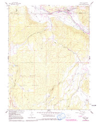
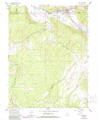
1961 Map of Basalt
USGS Topo · Published 1991About this map
The confluence of the Roaring Fork River and the Fryingpan River defines the valley at Basalt, a central point for trade and transport in the Rocky Mountain interior. The 1961 topography reveals the intricate water management essential to the region, marked by the Home Supply Ditch and a significant Aqueduct system near Wingo. While the northern edge of the map shows the development of settlements like Emma and Hooks, the southern portion is dominated by the expansive White River National Forest and the Maroon Bells-Snowmass Wilderness. The presence of the St Benedict Monastery near Capitol Creek suggests a quiet pocket of spiritual life separate from the ranching and irrigation activities on McCartney Mesa. This survey reflects the landscape just before the intense growth of mountain resort culture, showing the area as a functional intersection of agriculture, wildlife management at the Christine State Wildlife Area, and rugged high-country terrain.
Find a feature on this map
28 named features on this map. Tap any name to fly to it.
Don’t see what you’re looking for? This feature index may not catch every label — zoom into the map to look around manually.
Map Details
Editions of this 1961 Basalt Map
6 editions found

Other maps of this area

1893 · Aspen
USGS Topo · 1:62,500

1895 · Aspen
USGS Topo · 1:62,500

1909 · Mount Jackson
USGS Topo · 1:125,000

1911 · Mount Jackson
USGS Topo · 1:125,000

1957 · Leadville
USGS Topo · 1:250,000

1959 · Leadville
USGS Topo · 1:250,000

1960 · Leadville
USGS Topo · 1:250,000

1960 · Highland Peak
USGS Topo · 1:24,000

1960 · Capitol Peak
USGS Topo · 1:24,000

1960 · Redstone
USGS Topo · 1:24,000