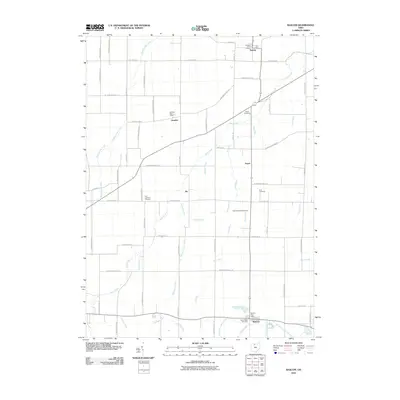
2010 Map of Bascom
USGS Topo · Published 2010About this map
Bascom and Kansas anchor this Seneca County landscape, reflecting the agricultural and small-town character of northwest Ohio in the early 21st century. The map details a transition from the compact settlement at Bascom, situated near the confluence of Eicher Ditch and the East Branch Wolf Creek, to the smaller hamlets of Amsden, Iler, and Angus. A complex drainage network defines the rural economy here, featuring named waterways like Plum Run, Wolf Creek, and several ditches including Sherger Ditch and Lynch Ditch. Genealogists will find significant value in the distribution of local burial grounds, ranging from Liberty Cemetery in the north to Sand Ridge Cemetery and Saint Andrews Cemetery further south, alongside established landmarks such as the Amsden Post Office.
Find a feature on this map
62 named features on this map. Tap any name to fly to it.
Don’t see what you’re looking for? This feature index may not catch every label — zoom into the map to look around manually.
Map Details
Editions of this 2010 Bascom Map
This is the sole edition of this map. No revisions or reprints were ever made.
Other maps of this area

1901 · Fostoria
USGS Topo · 1:62,500

1901 · Fremont
USGS Topo · 1:62,500

1901 · Elmore
USGS Topo · 1:62,500

1903 · Fremont
USGS Topo · 1:62,500

1903 · Fostoria
USGS Topo · 1:62,500

1903 · Elmore
USGS Topo · 1:62,500

1906 · Tiffin
USGS Topo · 1:62,500

1956 · Toledo
USGS Topo · 1:250,000

1958 · Fremont West
USGS Topo · 1:24,000
1958 · Bradner
USGS Topo · 1:24,000