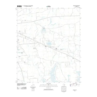
2010 Map of Bascom
USGS Topo · Published 2010About this map
Bascom and the surrounding Smith County landscape reflect a transition from agricultural roots to a reservoir-and-recreation economy by the early 21st century. The southeastern portion of the map is dominated by the northern reaches of Lake Tyler, which serves as a major regional water source and recreational hub, supplemented by Arp Club Lake and Camp Tyler. The geography is defined by numerous small drainages such as Gilley Creek and Prairie Creek, which have been utilized for local water management, evidenced by structures like the Pleasure Acres Lake Dam and Pinkerton Lake Dam.
Find a feature on this map
80 named features on this map. Tap any name to fly to it.
Don’t see what you’re looking for? This feature index may not catch every label — zoom into the map to look around manually.
Map Details
Editions of this 2010 Bascom Map
This is the sole edition of this map. No revisions or reprints were ever made.
Other maps of this area

1937 · Troupe
USGS Topo · 1:48,000

1938 · Winona
USGS Topo · 1:48,000

1943 · Troup
USGS Topo · 1:62,500

1943 · Winona
USGS Topo · 1:62,500

1946 · Bullard
USGS Topo · 1:62,500

1948 · Bullard
USGS Topo · 1:62,500

1948 · Tyler
USGS Topo · 1:62,500

1949 · Tyler
USGS Topo · 1:62,500

1956 · Tyler
USGS Topo · 1:250,000

1966 · Hope Pond
USGS Topo · 1:24,000