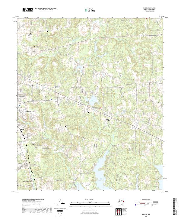
2022 Map of Bascom
USGS Topo · Published 2022About this map
The community of Bascom sits at the heart of this Smith County landscape, characterized by the winding tributaries of Harris Cr and Prairie Cr that feed into the northern reaches of Lake Tyler. This area southeast of Tyler shows a transition from suburban expansion near the University of Texas at Tyler to more traditional rural settlement patterns. Genealogy researchers will find an exceptional density of family and community burial grounds, including the Edwards-Emmanuel Cem, Belcher Cem, and the Saint Violet Cem to the north. The presence of newer landmarks like the East Texas Islamic Society Cem alongside established sites such as Bascom Cem reflects the evolving cultural fabric of the region. Local infrastructure is defined by a network of county roads and the Old Henderson Hwy, connecting small residential clusters like New Chapel Hill and Elberta to the larger centers of Whitehouse and Tyler.
Find a feature on this map
449 named features on this map. Tap any name to fly to it.
Don’t see what you’re looking for? This feature index may not catch every label — zoom into the map to look around manually.
Map Details
Editions of this 2022 Bascom Map
This is the sole edition of this map. No revisions or reprints were ever made.
Other maps of this area

1937 · Troupe
USGS Topo · 1:48,000

1938 · Winona
USGS Topo · 1:48,000

1943 · Troup
USGS Topo · 1:62,500

1943 · Winona
USGS Topo · 1:62,500

1946 · Bullard
USGS Topo · 1:62,500

1948 · Bullard
USGS Topo · 1:62,500

1948 · Tyler
USGS Topo · 1:62,500

1949 · Tyler
USGS Topo · 1:62,500

1956 · Tyler
USGS Topo · 1:250,000

1966 · Hope Pond
USGS Topo · 1:24,000