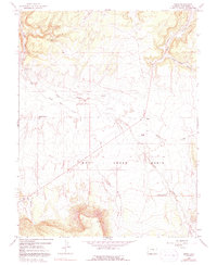
1964 Map of Basin
USGS Topo · Published 1991About this map
Dry Creek Basin dominates this 1964 survey of San Miguel County, showing a landscape defined by seasonal water and ranching infrastructure. The presence of the Basin Stock Driveway cutting across the terrain reflects the importance of moving livestock through this arid region between seasonal pastures. Local landmarks such as Beards Corner and the Young Ranch provide specific points of human habitation and navigation in an otherwise expansive system of canyons and plateaus.
Find a feature on this map
21 named features on this map. Tap any name to fly to it.
Don’t see what you’re looking for? This feature index may not catch every label — zoom into the map to look around manually.
Map Details
Editions of this 1964 Basin Map
4 editions found
Other maps of this area

1916 · Paradox Valley
USGS Topo · 1:125,000

1922 · Paradox Valley
USGS Topo · 1:125,000

1948 · Naturita NW
USGS Topo · 1:24,000

1948 · Gypsum Gap
USGS Topo · 1:24,000

1949 · Gypsum Gap
USGS Topo · 1:24,000

1949 · Naturita NW
USGS Topo · 1:24,000

1956 · Cortez
USGS Topo · 1:250,000

1956 · Moab
USGS Topo · 1:250,000

1958 · Cortez
USGS Topo · 1:250,000

1959 · Cortez
USGS Topo · 1:250,000