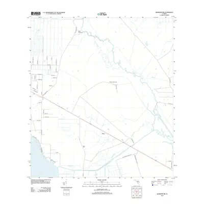
2012 Map of Basinger NW
USGS Topo · Published 2012About this map
Plains stands as a central point of settlement in this landscape defined by the complex water systems of central Florida. The southeastern shoreline of Lake Istokpoga dominates the bottom left, where the Istokpoga Canal and Istokpoga Cr manage the flow toward the winding Kissimmee River to the east. The terrain is marked by distinctive hammocks, including Bluff Hammock and Hickory Hammock, which provide slight elevation and ecological variety within the flatlands. A dense residential grid is visible in the northwest, featuring streets like Lakeshore Dr and Ute Ave, while the interior remains largely rural with local routes such as Bluff Hammock Rd cutting through the open country. Unique hydrological features like Hole in the Wall along the riverbanks and the nearby Lake Annie emphasize the region's reliance on and connection to its freshwater resources.
Find a feature on this map
49 named features on this map. Tap any name to fly to it.
Don’t see what you’re looking for? This feature index may not catch every label — zoom into the map to look around manually.
Map Details
Editions of this 2012 Basinger NW Map
This is the sole edition of this map. No revisions or reprints were ever made.
Other maps of this area

1952 · Fort Kissimmee
USGS Topo · 1:24,000

1952 · Lake Placid
USGS Topo · 1:24,000

1952 · Lake Arbuckle SE
USGS Topo · 1:24,000

1952 · Lorida
USGS Topo · 1:24,000

1953 · Basinger
USGS Topo · 1:24,000

1953 · Fort Basinger
USGS Topo · 1:24,000

1953 · Basinger SW
USGS Topo · 1:24,000

1953 · Basinger NW
USGS Topo · 1:24,000

1953 · Fort Kissimmee SE
USGS Topo · 1:24,000

1956 · Fort Pierce
USGS Topo · 1:250,000