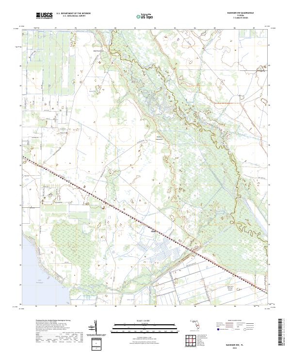
2024 Map of Basinger NW
USGS Topo · Published 2024About this map
The Kissimmee River meanders through the heart of this Highlands and Okeechobee County landscape, shaping a network of marshy features and hammocks. Small settlements like Plains and landmarks such as the Lykes Fort Basinger Airport stand alongside significant water bodies including the northeastern tip of Lake Istokpoga and the Istokpoga Canal. The map reveals the intricate drainage and canal system of South Central Florida, where Istokpoga Creek and Oak Creek feed into the river valley. Notable terrain features like Hickory Hammock, Bluff Hammock, and the curiously named Hole in the Wall indicate the varying elevation and vegetation patterns of the region. The Florida National Scenic Trl tracks the river corridor, providing a modern perspective on a landscape defined by historic water management and ranching roads like McArthur Rd and Co Rd 700.
Find a feature on this map
63 named features on this map. Tap any name to fly to it.
Don’t see what you’re looking for? This feature index may not catch every label — zoom into the map to look around manually.
Map Details
Editions of this 2024 Basinger NW Map
This is the sole edition of this map. No revisions or reprints were ever made.
Other maps of this area

1952 · Fort Kissimmee
USGS Topo · 1:24,000

1952 · Lake Placid
USGS Topo · 1:24,000

1952 · Lake Arbuckle SE
USGS Topo · 1:24,000

1952 · Lorida
USGS Topo · 1:24,000

1953 · Basinger
USGS Topo · 1:24,000

1953 · Fort Basinger
USGS Topo · 1:24,000

1953 · Basinger SW
USGS Topo · 1:24,000

1953 · Basinger NW
USGS Topo · 1:24,000

1953 · Fort Kissimmee SE
USGS Topo · 1:24,000

1956 · Fort Pierce
USGS Topo · 1:250,000