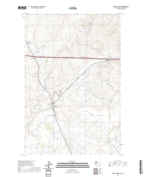
2023 Map of Bassett Junction
USGS Topo · Published 2023About this map
Bassett Junction and Ritell anchor a landscape defined by industrial-scale irrigation and historic transport corridors in central Washington. This 2023 survey by the U.S. Geological Survey illustrates the extensive network of the East Low Canal, which cuts east-west across the terrain, and its relationship to natural drainage features like Lind Coulee and Weber Coulee. The area is marked by several small settlements and siding locations, including Tiflis, Barham, and Atwood, many of which were historically linked to regional rail infrastructure. The grid of rural roads, such as RD 1 Se and RD 4 Se, overlays a geography shaped by the Columbia Basin Project, where the Weber Wasteway manages water flow through the arid coulees. Researchers can trace the sophisticated water management systems that transformed this part of Grant County into a productive agricultural region.
Find a feature on this map
47 named features on this map. Tap any name to fly to it.
Don’t see what you’re looking for? This feature index may not catch every label — zoom into the map to look around manually.
Map Details
Editions of this 2023 Bassett Junction Map
This is the sole edition of this map. No revisions or reprints were ever made.
Other maps of this area

1916 · Connell
USGS Topo · 1:125,000

1918 · Connell
USGS Topo · 1:125,000

1923 · Wheeler
USGS Topo · 1:62,500

1924 · Othello
USGS Topo · 1:62,500

1925 · Wheeler
USGS Topo · 1:62,500

1925 · Schrag
USGS Topo · 1:62,500

1953 · Walla Walla
USGS Topo · 1:250,000

1953 · Ritzville
USGS Topo · 1:250,000

1954 · Warden
USGS Topo · 1:24,000

1954 · Soda Lake
USGS Topo · 1:24,000