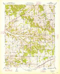
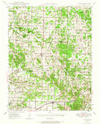
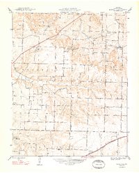
1961 Map of Bassville
USGS Topo · Published 1962About this map
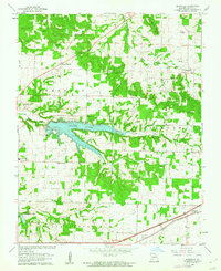
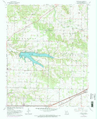
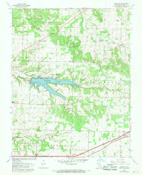
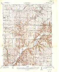
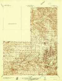
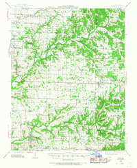
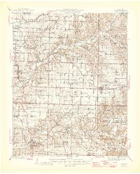
Fellows Lake dominates the central landscape of this 1961 revision, created by the impoundment of the Little Sac River. The map illustrates a pivotal era for northeastern Greene County, where traditional rural life—represented by the numerous country churches like Peace Chapel and Liberty Ch—begins to meet the infrastructure of a growing region. The southern edge is defined by the St Louis San Francisco railroad corridor, which skirts the community of Strafford. Local genealogy is well-preserved through detailed locations for Salem Cem and the Dishman Cem, while landmarks such as the Valley Water Mills and Fair Grove Mound provide clear topographical and cultural anchors. The transition from the rugged woods near Healee Spring to the organized township boundaries of Franklin and Jackson reveals a landscape defined by its water sources, including the Pomme de Terre River and South Dry Sac Creek.
Find a feature on this map
33 named features on this map. Tap any name to fly to it.
Don’t see what you’re looking for? This feature index may not catch every label — zoom into the map to look around manually.
Map Details
Editions of this 1961 Bassville Map
3 editions found
Other maps of this area

1884 · Springfield
USGS Topo · 1:125,000

1886 · Springfield
USGS Topo · 1:125,000
1935 · Springfield
USGS Topo · 1:24,000
1937 · Galloway
USGS Topo · 1:24,000
1937 · Ozark
USGS Topo · 1:48,000
1943 · Ozark
USGS Topo · 1:62,500
1945 · Ozark
USGS Topo · 1:62,500
1946 · Bassville
USGS Topo · 1:24,000
1947 · Strafford
USGS Topo · 1:62,500
1948 · Bassville
USGS Topo · 1:24,000