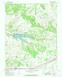
1961 Map of Bassville
USGS Topo · Published 1971About this map
Fellows Lake dominates the central landscape of this 1960s Greene County region, a significant reservoir formed along the Little Sac River. The map captures a mix of rural community life and infrastructure development just north of Springfield, with small clusters of settlement at Bassville and Hickory Barren. The agricultural character of the era is evident in the numerous small congregations and family landmarks that dot the countryside, including Peace Chapel, Elm Spring Ch, and Mt Comfort Ch.
Find a feature on this map
30 named features on this map. Tap any name to fly to it.
Don’t see what you’re looking for? This feature index may not catch every label — zoom into the map to look around manually.
Map Details
Editions of this 1961 Bassville Map
3 editions found
Other maps of this area

1884 · Springfield
USGS Topo · 1:125,000

1886 · Springfield
USGS Topo · 1:125,000

1935 · Springfield
USGS Topo · 1:24,000

1937 · Galloway
USGS Topo · 1:24,000

1937 · Ozark
USGS Topo · 1:48,000

1943 · Ozark
USGS Topo · 1:62,500

1945 · Ozark
USGS Topo · 1:62,500

1946 · Bassville
USGS Topo · 1:24,000

1947 · Strafford
USGS Topo · 1:62,500

1948 · Bassville
USGS Topo · 1:24,000