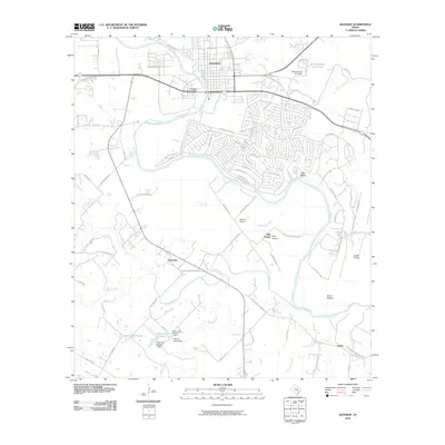
2010 Map of Bastrop
USGS Topo · Published 2010About this map
The Colorado River winds through the heart of this landscape, anchored by the town of Bastrop and the notable Colorado River Bridge. The terrain south of the river transitions into agricultural and ranching land, characterized by expansive areas like Hills Prairie and the low-lying David Bottom. The local road network, including the historic El Camino Real River Rd, connects smaller outlying communities such as Clearview and Upton.
Find a feature on this map
79 named features on this map. Tap any name to fly to it.
Don’t see what you’re looking for? This feature index may not catch every label — zoom into the map to look around manually.
Map Details
Editions of this 2010 Bastrop Map
This is the sole edition of this map. No revisions or reprints were ever made.
Other maps of this area

1885 · Bastrop
USGS Topo · 1:125,000

1893 · Bastrop
USGS Topo · 1:125,000

1901 · Flatonia
USGS Topo · 1:125,000

1904 · Bastrop
USGS Topo · 1:125,000

1948 · Smithville
USGS Topo · 1:62,500

1948 · Bastrop
USGS Topo · 1:62,500

1950 · Bastrop
USGS Topo · 1:62,500

1950 · Smithville
USGS Topo · 1:62,500

1953 · Seguin
USGS Topo · 1:250,000

1954 · Austin
USGS Topo · 1:250,000