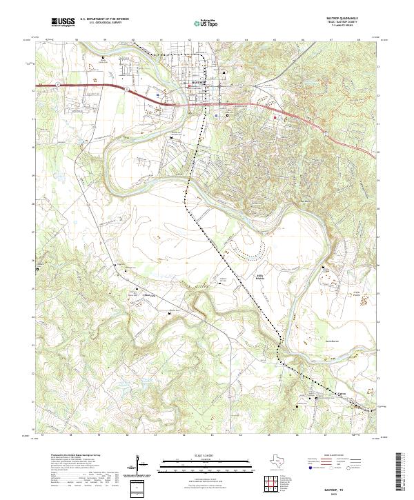
2022 Map of Bastrop
USGS Topo · Published 2022About this map
Bastrop serves as the focal point of this Central Texas landscape, where the Colorado River carves a winding path past the Bastrop County Courthouse and through the distinctive Red Bluffs. This modern survey reveals a dense network of local-history markers, particularly the numerous family and community burial grounds that dot the countryside, such as Fairview Cem, Kellough Cem, and the Clearview Hills Prairie Cem. The eastern portion of the map is dominated by the ecological transition into the pine-oak woodlands of Bastrop State Park, while the southern reaches descend into the river bottomlands at David Bottom. Smaller rural settlements like Upton, Clearview, and Hills Prairie maintain their distinct identities amidst a complex of creek systems including Walnut Cr and Sandy Cr. The map provides a contemporary view of the region's geography, from the established streets of the county seat to the managed waters of Duke Lake Number 1.
Find a feature on this map
214 named features on this map. Tap any name to fly to it.
Don’t see what you’re looking for? This feature index may not catch every label — zoom into the map to look around manually.
Map Details
Editions of this 2022 Bastrop Map
This is the sole edition of this map. No revisions or reprints were ever made.
Other maps of this area

1885 · Bastrop
USGS Topo · 1:125,000

1893 · Bastrop
USGS Topo · 1:125,000

1901 · Flatonia
USGS Topo · 1:125,000

1904 · Bastrop
USGS Topo · 1:125,000

1948 · Smithville
USGS Topo · 1:62,500

1948 · Bastrop
USGS Topo · 1:62,500

1950 · Bastrop
USGS Topo · 1:62,500

1950 · Smithville
USGS Topo · 1:62,500

1953 · Seguin
USGS Topo · 1:250,000

1954 · Austin
USGS Topo · 1:250,000