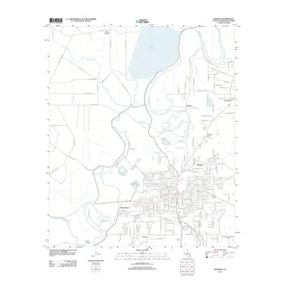
2012 Map of Bastrop
USGS Topo · Published 2012About this map
Bayou Bartholomew snakes through the heart of this Morehouse Parish landscape, defining the drainage patterns and historical settlement boundaries north of Bastrop. The 2012 geography is marked by a complex network of named roads like Long Lonesome Rd and Thorny Brake Rd, which lead to residential clusters such as Point Pleasant and Newlock. To the north, the massive reservoir of Bussy Brake dominates the terrain, while smaller water features like Tisdale Brake and Anderson Lake reflect the low-lying, wetland-rich nature of the region. Local history is anchored by several community landmarks, including Anderson Chapel and its associated Anderson Chapel Cem, alongside other burial sites such as Carter Cem and Bell Cem. These features, combined with the presence of Morehouse Memorial Park, illustrate a landscape where modern development and traditional rural markers coexist.
Find a feature on this map
220 named features on this map. Tap any name to fly to it.
Don’t see what you’re looking for? This feature index may not catch every label — zoom into the map to look around manually.
Map Details
Editions of this 2012 Bastrop Map
This is the sole edition of this map. No revisions or reprints were ever made.
Other maps of this area

1935 · Collinston
USGS Topo · 1:62,500

1935 · Naff
USGS Topo · 1:62,500

1935 · Drew
USGS Topo · 1:62,500

1935 · Haile
USGS Topo · 1:62,500

1955 · Jackson
USGS Topo · 1:250,000

1955 · Shreveport
USGS Topo · 1:250,000

1956 · Shreveport
USGS Topo · 1:250,000

1956 · Bastrop
USGS Topo · 1:62,500

1956 · Haile
USGS Topo · 1:62,500

1957 · Monroe North
USGS Topo · 1:62,500