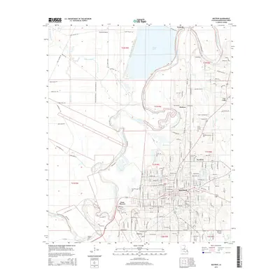
2015 Map of Bastrop
USGS Topo · Published 2015About this map
Bastrop serves as the central hub of this 2015 survey, where the winding course of Bayou Bartholomew dictates the layout of local infrastructure and neighborhood growth. The map illustrates a landscape defined by its waterways, from the large expanse of Bussy Brake in the north to the oxbows of Horse Bayou and Anderson Lake further south. These natural boundaries shape the development of surrounding communities like Wardville, Sheltons, and Point Pleasant.
Find a feature on this map
181 named features on this map. Tap any name to fly to it.
Don’t see what you’re looking for? This feature index may not catch every label — zoom into the map to look around manually.
Map Details
Editions of this 2015 Bastrop Map
This is the sole edition of this map. No revisions or reprints were ever made.
Other maps of this area

1935 · Collinston
USGS Topo · 1:62,500

1935 · Naff
USGS Topo · 1:62,500

1935 · Drew
USGS Topo · 1:62,500

1935 · Haile
USGS Topo · 1:62,500

1955 · Jackson
USGS Topo · 1:250,000

1955 · Shreveport
USGS Topo · 1:250,000

1956 · Shreveport
USGS Topo · 1:250,000

1956 · Bastrop
USGS Topo · 1:62,500

1956 · Haile
USGS Topo · 1:62,500

1957 · Monroe North
USGS Topo · 1:62,500