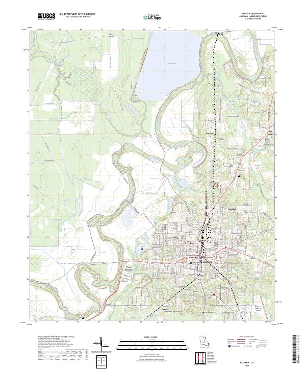
2024 Map of Bastrop
USGS Topo · Published 2024About this map
Bastrop serves as the focal point of this Morehouse Parish landscape, characterized by the winding path of Bayou Bartholomew and the expansive Bussy Brake. The map illustrates a well-developed network of infrastructure, including the Alabama & Gulf Coast Railway and the Morehouse Memorial Airport. Cultural and civic centers are clearly identified, such as the Morehouse Parish Courthouse and the Louisiana Delta Community College Bastrop Campus. Beyond the city limits, smaller settlements like Sheltons, Newlock, and Point Pleasant are interspersed with agricultural and marshy terrain, such as Prairie de Butte and Tisdale Brake. Local family history is well-represented through several sites, including Pine Grove Cem, Bell Cem, and the Anderson Chapel Gem. The convergence of bayous like Cypress Bayou and Horse Bayou demonstrates the complex hydrography that has long influenced settlement patterns in this northern Louisiana region.
Find a feature on this map
215 named features on this map. Tap any name to fly to it.
Don’t see what you’re looking for? This feature index may not catch every label — zoom into the map to look around manually.
Map Details
Editions of this 2024 Bastrop Map
This is the sole edition of this map. No revisions or reprints were ever made.
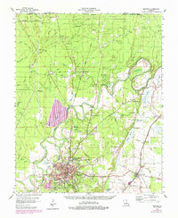
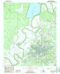
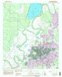
Historical Maps of Point Pleasant Through Time
5 maps found