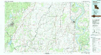
1982 Map of Bastrop
USGS Topo · Published 1983About this map
The low-lying wetlands and floodplains of Northeastern Louisiana and Western Mississippi dominate this 1982 survey, defined by the winding course of the Mississippi River and the bayous that lattice the landscape. The industrial and agricultural center of Bastrop serves as a primary hub, situated near the Missouri Pacific RR and the Morehouse Memorial Airport. To the east, Lake Providence sits along the river's edge, surrounded by a complex system of islands and towheads like Pittman Island and Duncansby Towhead. The map illustrates a region transitioning between managed wilderness and rural agriculture, featuring large tracts of protected land such as the Georgia Pacific State Wildlife Management Area and the archaeological surroundings of Poverty Point State Park. Numerous small settlements, including Mer Rouge, Oak Grove, and Bonita, are connected by a dense network of state highways, reflecting the established rural community structure of the late 20th century.
Find a feature on this map
124 named features on this map. Tap any name to fly to it.
Don’t see what you’re looking for? This feature index may not catch every label — zoom into the map to look around manually.
Map Details
Editions of this 1982 Bastrop Map
This is the sole edition of this map. No revisions or reprints were ever made.
Other maps of this area

1909 · Baxter Bayou
USGS Topo · 1:24,000

1909 · Millikens Bend
USGS Topo · 1:24,000

1909 · Lake Providence
USGS Topo · 1:24,000

1909 · Tallulah
USGS Topo · 1:24,000

1909 · Wilsons Point
USGS Topo · 1:24,000

1909 · Millikin
USGS Topo · 1:24,000

1909 · Ashton Bridge
USGS Topo · 1:24,000

1911 · Lake Providence
USGS Topo · 1:31,680

1911 · Baxter Bayou
USGS Topo · 1:24,000

1912 · Ashton Bridge
USGS Topo · 1:31,680