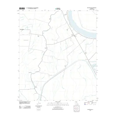
2012 Map of Batchelor
USGS Topo · Published 2012About this map
Batchelor and New California anchor this 2012 survey of the low-lying terrain in northern Pointe Coupee Parish, where the land is defined by an intricate network of waterways like Bayou Latenache and Bee Tree Bayou. The map illustrates a landscape shaped by both agriculture and industry, with the Bayou Garwood Oil Field situated west of the central bayous. Local heritage is preserved through several community landmarks, including Little Zion Cem, Mount Marias Cem, and the Lower Latenache Church. Transport routes such as Lacour Spur and the various residential streets in Batchelor show the modern configuration of this rural Louisiana parish. The drainage patterns, represented by Wilson Ditch and numerous bayous like Bayou White Vine, reveal the complex hydrology typical of the region's alluvial plains during the early 21st century.
Find a feature on this map
49 named features on this map. Tap any name to fly to it.
Don’t see what you’re looking for? This feature index may not catch every label — zoom into the map to look around manually.
Map Details
Editions of this 2012 Batchelor Map
This is the sole edition of this map. No revisions or reprints were ever made.
Other maps of this area

1939 · Fordoche
USGS Topo · 1:62,500

1941 · Batchelor
USGS Topo · 1:62,500

1954 · Baton Rouge
USGS Topo · 1:250,000

1955 · Fordoche
USGS Topo · 1:62,500

1955 · Batchelor
USGS Topo · 1:62,500

1955 · Odenburg
USGS Topo · 1:62,500

1956 · Baton Rouge
USGS Topo · 1:250,000

1959 · Fordoche
USGS Topo · 1:62,500

1959 · Palmetto
USGS Topo · 1:62,500

1961 · Baton Rouge
USGS Topo · 1:250,000