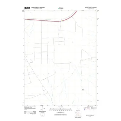
2012 Map of Bateman Spring
USGS Topo · Published 2012About this map
Lander County Airport and the small settlement of Rosny anchor the northern landscape of this Nevada basin. To the south, the Marvel Ranch sits at the junction of Hilltop Rd and James Buchanan Ave, marking a pocket of activity in an otherwise sparse high-desert environment. The eastern edge of the map is defined by the steep rises of the Shoshone Range, where Slaven Canyon and Slaven Creek carve through the terrain. A grid of planned streets such as Presidential Blvd and Conestoga Rd stretches across the center, illustrating modern land division patterns. Natural water sources like Bateman Spring and the drainage of Rock Creek provide essential orientation points within this arid territory.
Find a feature on this map
27 named features on this map. Tap any name to fly to it.
Don’t see what you’re looking for? This feature index may not catch every label — zoom into the map to look around manually.
Map Details
Editions of this 2012 Bateman Spring Map
This is the sole edition of this map. No revisions or reprints were ever made.
Other maps of this area

1949 · Crescent Valley
USGS Topo · 1:62,500

1949 · Mt. Lewis
USGS Topo · 1:62,500

1950 · Mt. Lewis
USGS Topo · 1:62,500

1950 · Crescent Valley
USGS Topo · 1:62,500

1955 · Winnemucca
USGS Topo · 1:250,000

1957 · Dunphy
USGS Topo · 1:62,500

1957 · Battle Mountain
USGS Topo · 1:62,500

1958 · Winnemucca
USGS Topo · 1:250,000

1962 · Winnemucca
USGS Topo · 1:250,000

1985 · Mud Spring Gulch
USGS Topo · 1:24,000