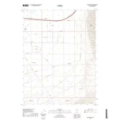
2018 Map of Bateman Spring
USGS Topo · Published 2018About this map
Battle Mountain Airport anchors the western edge of this Nevada landscape, where the high desert floor meets the rising peaks of the Shoshone Range. This 2018 survey documents a region defined by its water sources and drainage patterns, with Bateman Spring and Rock Cr providing vital points of reference in an otherwise arid basin. The map reveals a structured grid of named thoroughfares like James Buchanan Ave and Presidential Ave, indicating planned expansion or rural development around the settlement area of Rosny. To the southeast, the terrain becomes increasingly complex as the flats transition into the steep walls of Slaven Canyon. This intersection of modern infrastructure and natural geographic features, including Slaven Cr and Batemans Cr, illustrates the ongoing human effort to navigate and utilize the Great Basin's challenging environment.
Find a feature on this map
44 named features on this map. Tap any name to fly to it.
Don’t see what you’re looking for? This feature index may not catch every label — zoom into the map to look around manually.
Map Details
Editions of this 2018 Bateman Spring Map
This is the sole edition of this map. No revisions or reprints were ever made.
Other maps of this area

1949 · Crescent Valley
USGS Topo · 1:62,500

1949 · Mt. Lewis
USGS Topo · 1:62,500

1950 · Mt. Lewis
USGS Topo · 1:62,500

1950 · Crescent Valley
USGS Topo · 1:62,500

1955 · Winnemucca
USGS Topo · 1:250,000

1957 · Dunphy
USGS Topo · 1:62,500

1957 · Battle Mountain
USGS Topo · 1:62,500

1958 · Winnemucca
USGS Topo · 1:250,000

1962 · Winnemucca
USGS Topo · 1:250,000

1985 · Mud Spring Gulch
USGS Topo · 1:24,000