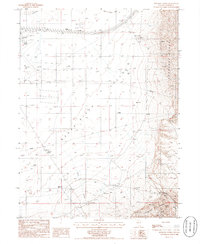
1986 Map of Bateman Spring
USGS Topo · Published 1986About this map
Reese River Valley dominates this mid-1980s topographical survey, a wide expanse of the Great Basin terrain in Lander County. To the east, the Shoshone Range rises sharply, marked by high-elevation Prospects and a Mine Shaft, while the valley floor is defined by seasonal water sources like Rock Creek and Bateman Spring. This landscape shows a layering of historical passage and modern utility, where the ancient path of the Old Calif Trail cuts across the northern reaches, contrasted by a modern Pipeline and Powerline that traverse the basin. Remote outposts such as Marvel Ranch and Rosny provide rare points of human habitation, while the presence of the County Airport and its accompanying Air Beacon indicates the importance of aerial navigation in this sparsely populated stretch of the Nevada desert.
Find a feature on this map
28 named features on this map. Tap any name to fly to it.
Don’t see what you’re looking for? This feature index may not catch every label — zoom into the map to look around manually.
Map Details
Editions of this 1986 Bateman Spring Map
This is the sole edition of this map. No revisions or reprints were ever made.
Other maps of this area

1949 · Crescent Valley
USGS Topo · 1:62,500

1949 · Mt. Lewis
USGS Topo · 1:62,500

1950 · Mt. Lewis
USGS Topo · 1:62,500

1950 · Crescent Valley
USGS Topo · 1:62,500

1955 · Winnemucca
USGS Topo · 1:250,000

1957 · Dunphy
USGS Topo · 1:62,500

1957 · Battle Mountain
USGS Topo · 1:62,500

1958 · Winnemucca
USGS Topo · 1:250,000

1962 · Winnemucca
USGS Topo · 1:250,000

1985 · Mud Spring Gulch
USGS Topo · 1:24,000