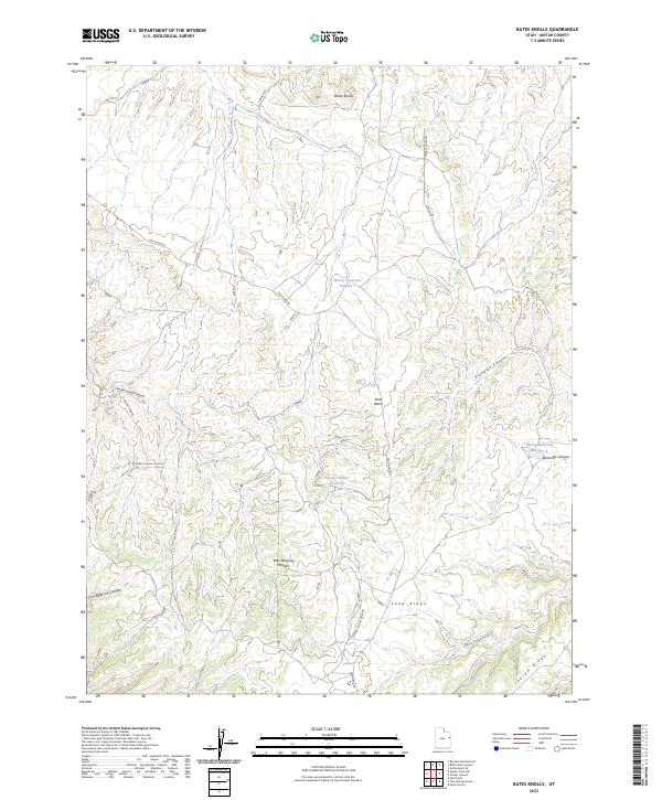
2023 Map of Bates Knolls
USGS Topo · Published 2023About this map
The East Tavaputs Plateau landscape is defined by its complex drainage systems and high-altitude relief. Water management in this arid Uintah County terrain is evidenced by several catchment sites, including McCoy Reservoir Number 1 and McCoy Reservoir Number 2, which suggest a history of seasonal ranching or resource use. The named prominence of Bates Knolls stands at the north, while the southern reaches are marked by the steady rise of Indian Ridge. Accessibility across this rugged topography is facilitated by the Seep Ridge Rd and the Weeks Access Rd, which connect various drainage basins like Sunday School Canyon and Klondike Canyon. This layout illustrates a remote backcountry geography where named canyons and ridges provide the primary navigational framework for the area.
Find a feature on this map
19 named features on this map. Tap any name to fly to it.
Don’t see what you’re looking for? This feature index may not catch every label — zoom into the map to look around manually.
Map Details
Editions of this 2023 Bates Knolls Map
This is the sole edition of this map. No revisions or reprints were ever made.
Other maps of this area

1885 · East Tavaputs
USGS Topo · 1:250,000

1956 · Grand Junction
USGS Topo · 1:250,000

1959 · Grand Junction
USGS Topo · 1:250,000

1960 · Grand Junction
USGS Topo · 1:250,000

1962 · Grand Junction
USGS Topo · 1:250,000

1964 · Grand Junction
USGS Topo · 1:250,000

1965 · Grand Junction
USGS Topo · 1:250,000

1966 · Seep Canyon
USGS Topo · 1:24,000

1966 · Bates Knolls
USGS Topo · 1:24,000
1966 · Agency Draw NE
USGS Topo · 1:24,000