
1966 Map of Seep Canyon
USGS Topo · Published 1969About this map
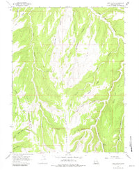
Seep Ridge and Monument Ridge dominate this corner of Uintah County, Utah, where a complex network of high ridges and deep canyons defines the landscape. The geography is characterized by an intricate drainage pattern, featuring Seep Canyon, Crooked Canyon, and Trap Canyon which carve through the high plateaus. Human presence is marked by utility and transport routes that navigate the terrain, such as a Pipeline and the historic Wagon Road traversing Jacks Canyon. These routes suggest the area's role in the region's energy and transit development during the mid-1960s. For those tracing historical movement through this territory, the map documents numerous trails, including a Jeep Trail and various unnamed paths that connect remote features like Willow Spring and the secluded Hideout Canyon.
Find a feature on this map
23 named features on this map. Tap any name to fly to it.
Don’t see what you’re looking for? This feature index may not catch every label — zoom into the map to look around manually.
Map Details
Editions of this 1966 Seep Canyon Map
3 editions found
Other maps of this area

1885 · East Tavaputs
USGS Topo · 1:250,000

1956 · Grand Junction
USGS Topo · 1:250,000

1959 · Grand Junction
USGS Topo · 1:250,000

1960 · Grand Junction
USGS Topo · 1:250,000

1962 · Grand Junction
USGS Topo · 1:250,000

1964 · Grand Junction
USGS Topo · 1:250,000

1965 · Grand Junction
USGS Topo · 1:250,000

1966 · Bates Knolls
USGS Topo · 1:24,000

1966 · Tom Patterson Canyon
USGS Topo · 1:24,000
1966 · Copper Canyon
USGS Topo · 1:24,000