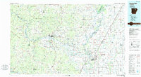
1986 Map of Batesville
USGS Topo · Published 1986About this map
The White River and its major tributaries, including the Black River and Strawberry River, dominate this mid-1980s portrait of the Arkansas Ozarks fringe. The landscape transitions from the higher elevations of the Ozark Mountains in the northwest to the alluvial bottomlands of the Mississippi Embayment to the southeast. Transport and commerce are defined by the Missouri Pacific Railroad and arterial routes like U.S. Highway 167, which link the regional hubs of Batesville and Newport.
Find a feature on this map
266 named features on this map. Tap any name to fly to it.
Don’t see what you’re looking for? This feature index may not catch every label — zoom into the map to look around manually.
Map Details
Editions of this 1986 Batesville Map
2 editions found
Other maps of this area

1890 · Batesville
USGS Topo · 1:125,000

1890 · Mountain Home
USGS Topo · 1:125,000

1891 · Mountain Home
USGS Topo · 1:125,000

1891 · Batesville
USGS Topo · 1:125,000

1892 · Mountain View
USGS Topo · 1:125,000

1894 · Mountain View
USGS Topo · 1:125,000

1894 · Mountain Home
USGS Topo · 1:125,000

1932 · Strawberry
USGS Topo · 1:62,500

1932 · Walnut Ridge
USGS Topo · 1:62,500

1934 · Powhatan
USGS Topo · 1:62,500