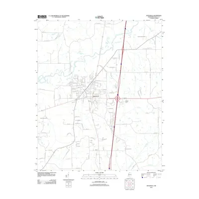
2012 Map of Batesville
USGS Topo · Published 2012About this map
Batesville serves as the focal point of this Panola County landscape, where modern transportation infrastructure meets the winding path of the Little Tallahatchie River. The town's grid expands southward from the riverbanks, punctuated by local landmarks such as Magnolia Cem and the Batesville Lookout Tower. Aviation is represented by both the Panola County Airport to the northeast and the smaller Noles Landing Strip to the west, reflecting the region's connectivity. Outside the main settlement, the terrain is defined by a dense network of waterways including Buck Horn Cr, Viney Cr, and Sand Cr, which drain into the river basin. Smaller community centers and rural sites are marked by features like Shiloh Cem and Bobo Bayou, providing specific points of interest for those researching local family history or the geographical layout of northern Mississippi during this era.
Find a feature on this map
143 named features on this map. Tap any name to fly to it.
Don’t see what you’re looking for? This feature index may not catch every label — zoom into the map to look around manually.
Map Details
Editions of this 2012 Batesville Map
This is the sole edition of this map. No revisions or reprints were ever made.
Other maps of this area

1932 · Sledge
USGS Topo · 1:48,000

1935 · Crowder
USGS Topo · 1:62,500

1935 · Sledge
USGS Topo · 1:62,500

1939 · Sledge
USGS Topo · 1:62,500

1939 · Crowder
USGS Topo · 1:62,500

1948 · Helena
USGS Topo · 1:250,000

1950 · Helena
USGS Topo · 1:250,000

1952 · Sardis
USGS Topo · 1:62,500

1953 · Sardis
USGS Topo · 1:62,500

1954 · Oakland
USGS Topo · 1:62,500