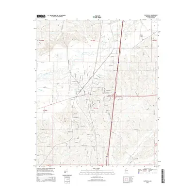
2015 Map of Batesville
USGS Topo · Published 2015About this map
Batesville sits at the heart of this landscape, where the Little Tallahatchie River meanders across the northwestern quadrant. The town's grid is dense with residential development and commercial corridors, while the surrounding Panola County terrain is defined by a intricate network of waterways including Buck Horn Creek and Hurt Creek. Local history and genealogy are anchored by sites such as Magnolia Cemetery and Shiloh Cemetery, located south of the main settlement.
Find a feature on this map
125 named features on this map. Tap any name to fly to it.
Don’t see what you’re looking for? This feature index may not catch every label — zoom into the map to look around manually.
Map Details
Editions of this 2015 Batesville Map
This is the sole edition of this map. No revisions or reprints were ever made.
Other maps of this area

1932 · Sledge
USGS Topo · 1:48,000

1935 · Crowder
USGS Topo · 1:62,500

1935 · Sledge
USGS Topo · 1:62,500

1939 · Sledge
USGS Topo · 1:62,500

1939 · Crowder
USGS Topo · 1:62,500

1948 · Helena
USGS Topo · 1:250,000

1950 · Helena
USGS Topo · 1:250,000

1952 · Sardis
USGS Topo · 1:62,500

1953 · Sardis
USGS Topo · 1:62,500

1954 · Oakland
USGS Topo · 1:62,500