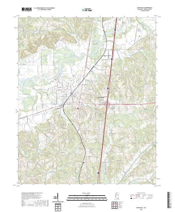
2024 Map of Batesville
USGS Topo · Published 2024About this map
The city of Batesville functions as a critical crossroads in north Mississippi, situated where the rolling uplands meet the alluvial drainage of the Little Tallahatchie River. At the heart of the community stands the Panola County Courthouse Batesville, anchoring a grid of streets that extend toward the convergence of Us HWY 51 and MS HWY 6. This modern survey illustrates the intensive integration of regional transportation, with I-55 bisecting the landscape and providing a sharp contrast to the meandering paths of Sand Creek and Hurt Creek. To the south and west, the terrain transitions into a patchwork of rural roads and water features like Bobo Bayou, while established sites such as Magnolia Cem and Shiloh Cem provide significant points of reference for genealogists tracking family history in the t8s r7w and t9s r7w townships.
Find a feature on this map
121 named features on this map. Tap any name to fly to it.
Don’t see what you’re looking for? This feature index may not catch every label — zoom into the map to look around manually.
Map Details
Editions of this 2024 Batesville Map
This is the sole edition of this map. No revisions or reprints were ever made.
Other maps of this area

1932 · Sledge
USGS Topo · 1:48,000

1935 · Crowder
USGS Topo · 1:62,500

1935 · Sledge
USGS Topo · 1:62,500

1939 · Sledge
USGS Topo · 1:62,500

1939 · Crowder
USGS Topo · 1:62,500

1948 · Helena
USGS Topo · 1:250,000

1950 · Helena
USGS Topo · 1:250,000

1952 · Sardis
USGS Topo · 1:62,500

1953 · Sardis
USGS Topo · 1:62,500

1954 · Oakland
USGS Topo · 1:62,500