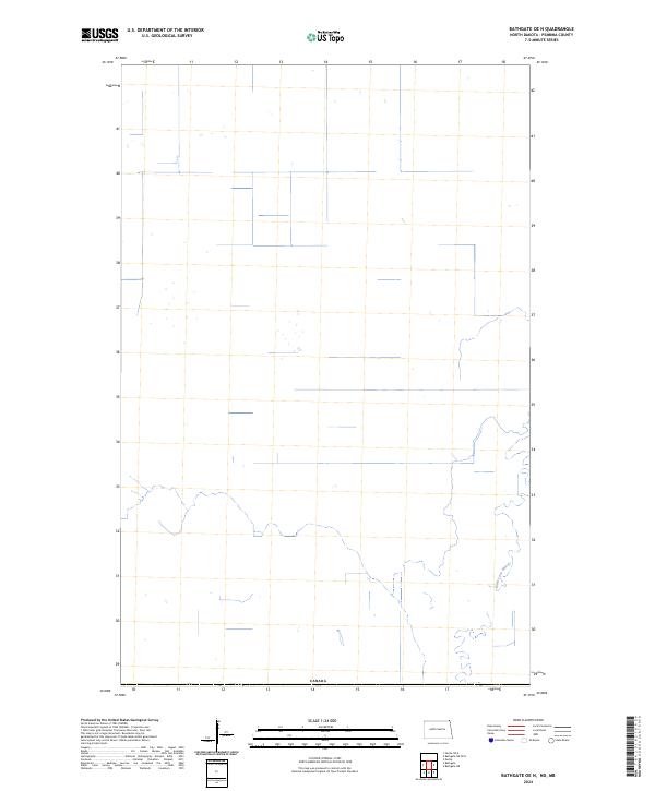
2024 Map of Bathgate OE N
USGS Topo · Published 2024About this map
The winding Rivière aux Marais dominates the eastern and southern reaches of this northern Pembina County landscape, its meandering channel defining the local drainage pattern just south of the international border. This modern survey illustrates the vast open space along the boundary with Canada, where a simple grid of section lines and scattered wetland pockets characterizes the terrain. The map serves as a contemporary record of the agricultural and hydraulic layout in this part of North Dakota, focusing on the natural watercourse of the river and the stark geometric boundaries of the northern plains.
Find a feature on this map
2 named features on this map. Tap any name to fly to it.
Don’t see what you’re looking for? This feature index may not catch every label — zoom into the map to look around manually.
Map Details
Editions of this 2024 Bathgate OE N Map
This is the sole edition of this map. No revisions or reprints were ever made.
Other maps of this area

1939 · Cavalier
USGS Topo · 1:62,500

1941 · Cavalier
USGS Topo · 1:62,500

1941 · Bathgate
USGS Topo · 1:62,500

1952 · Thief River Falls
USGS Topo · 1:250,000

1956 · Thief River Falls
USGS Topo · 1:250,000

1957 · Thief River Falls
USGS Topo · 1:250,000

1964 · Neche
USGS Topo · 1:24,000

1967 · Thief River Falls
USGS Topo · 1:250,000
1970 · Bathgate NE
USGS Topo · 1:24,000
1971 · Bathgate
USGS Topo · 1:24,000