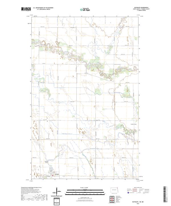
2024 Map of Bathgate
USGS Topo · Published 2024About this map
The Bathgate townsite anchors the southwestern corner of this survey, where the Tongue River meets its managed waterway systems in Pembina County. The landscape is defined by the winding paths of the Pembina River to the north and the Tongue River to the south, both of which exhibit the characteristic meandering patterns of the Red River Valley. Human engineering is visible through an extensive network of drainage infrastructure, including the Tongue River Cutoff, County Ditch Number 17, and County Drain Number 22, which manage the low-lying prairie for agricultural use. Natural drainage features such as Rosebud Coulee and Louden Coulee provide topographic relief to the otherwise level terrain. The map records the precise street grid of the settlement, including Arthur St and W Division St, alongside the section lines that organize the surrounding farmland.
Find a feature on this map
35 named features on this map. Tap any name to fly to it.
Don’t see what you’re looking for? This feature index may not catch every label — zoom into the map to look around manually.
Map Details
Editions of this 2024 Bathgate Map
This is the sole edition of this map. No revisions or reprints were ever made.
Other maps of this area

1939 · Cavalier
USGS Topo · 1:62,500

1941 · Cavalier
USGS Topo · 1:62,500

1941 · Bathgate
USGS Topo · 1:62,500

1952 · Thief River Falls
USGS Topo · 1:250,000

1956 · Thief River Falls
USGS Topo · 1:250,000

1957 · Thief River Falls
USGS Topo · 1:250,000

1964 · Neche
USGS Topo · 1:24,000
1964 · Cavalier
USGS Topo · 1:24,000

1967 · Thief River Falls
USGS Topo · 1:250,000
1970 · Bathgate SE
USGS Topo · 1:24,000