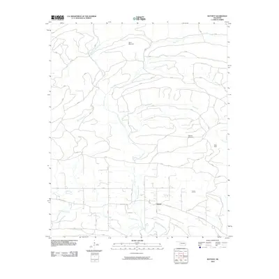
2010 Map of Battiest
USGS Topo · Published 2010About this map
The community of Battiest serves as the focal point of this 2010 survey, located in the forested landscape of southeastern Oklahoma. The area is defined by the winding course of the West Fork Glover River, which draws in numerous tributaries including Bluff Creek and Silver Creek. The terrain is characterized by significant rises such as Short Mountain to the north and High Peak and Second Mountain to the east, reflecting the upland character of McCurtain County. Local infrastructure is primarily represented by Main County St and Battiest Rd, which connect the settlement to the surrounding ridges. For those researching family history in the region, the Parsons Cemetery is a prominent landmark located northeast of the main town site, providing a tangible link to the area's residents during this period.
Find a feature on this map
16 named features on this map. Tap any name to fly to it.
Don’t see what you’re looking for? This feature index may not catch every label — zoom into the map to look around manually.
Map Details
Editions of this 2010 Battiest Map
This is the sole edition of this map. No revisions or reprints were ever made.
Other maps of this area

1900 · Winding Stair
USGS Topo · 1:125,000

1901 · Tuskahoma
USGS Topo · 1:125,000

1901 · Alikchi
USGS Topo · 1:125,000

1902 · Lukfata
USGS Topo · 1:125,000

1908 · Tuskahoma
USGS Topo · 1:125,000

1909 · Tuskahoma
USGS Topo · 1:125,000

1909 · Winding Stair
USGS Topo · 1:125,000

1950 · Mcalester
USGS Topo · 1:250,000

1960 · Bethel
USGS Topo · 1:62,500

1962 · McAlester
USGS Topo · 1:250,000