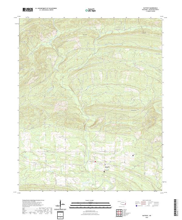
2022 Map of Battiest
USGS Topo · Published 2022About this map
Battiest is situated in the southeastern reaches of Oklahoma, where the W Fork Glover River winds through a landscape of prominent peaks and timbered ridges. This McCurtain County territory is defined by its distinct topography, featuring Short Mtn in the north and the rising elevation of High Peak in the east. The river system, including West Fork Glover River and various tributaries like Bluff Cr and Coon Cr, dictates the layout of local travel routes such as Battiest Rd and the Wild Horse Trl. Family history is anchored at the Battiest Cem and Parsons Cem, which serve as permanent markers of the community's heritage amidst the mountain terrain. The map's layout of section lines and township boundaries, including t1s r23e, provides a clear framework for tracing land ownership and ancestral homesteads in this rural upland setting.
Find a feature on this map
26 named features on this map. Tap any name to fly to it.
Don’t see what you’re looking for? This feature index may not catch every label — zoom into the map to look around manually.
Map Details
Editions of this 2022 Battiest Map
This is the sole edition of this map. No revisions or reprints were ever made.
Other maps of this area

1900 · Winding Stair
USGS Topo · 1:125,000

1901 · Tuskahoma
USGS Topo · 1:125,000

1901 · Alikchi
USGS Topo · 1:125,000

1902 · Lukfata
USGS Topo · 1:125,000

1908 · Tuskahoma
USGS Topo · 1:125,000

1909 · Tuskahoma
USGS Topo · 1:125,000

1909 · Winding Stair
USGS Topo · 1:125,000

1950 · Mcalester
USGS Topo · 1:250,000

1960 · Bethel
USGS Topo · 1:62,500

1962 · McAlester
USGS Topo · 1:250,000