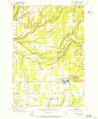
1954 Map of Battle Ground
USGS Topo · Published 1955About this map
The East Fork Lewis River snakes through the center of this mid-century Washington landscape, anchoring a network of small agricultural settlements and timber-adjacent communities. The town of Battle Ground serves as the primary hub, where the Northern Pacific railroad line intersects with the Battle Ground Road. This period survey highlights several distinct rural corners such as Dollar Corner, Scotton Corner, and Charter Oak, each reflecting the organized settlement patterns of Clark County.
Find a feature on this map
30 named features on this map. Tap any name to fly to it.
Don’t see what you’re looking for? This feature index may not catch every label — zoom into the map to look around manually.
Map Details
Editions of this 1954 Battle Ground Map
3 editions found
Other maps of this area

1897 · Portland
USGS Topo · 1:62,500

1905 · Portland
USGS Topo · 1:62,500

1918 · Troutdale
USGS Topo · 1:62,500

1934 · Troutdale
USGS Topo · 1:48,000

1940 · Portland
USGS Topo · 1:62,500

1940 · La Center
USGS Topo · 1:62,500

1941 · Yacolt
USGS Topo · 1:62,500

1941 · Camas
USGS Topo · 1:62,500

1942 · Camas
USGS Topo · 1:62,500

1948 · Vancouver
USGS Topo · 1:250,000