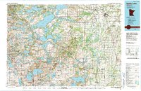
1986 Map of Battle Lake
USGS Topo · Published 1991About this map
Otter Tail Lake and the intricate glacial waters of the west-central Minnesota lake country dominate this mid-1980s landscape. This region, where the prairie begins to give way to the hardwood forests of Maplewood State Park, is defined by a dense concentration of named basins including West Battle Lake, Lake Miltona, and Lake Christina. The settlement pattern follows the established corridors of the Burlington Northern and Soo Line railroads, connecting towns such as Wadena, Henning, and Battle Lake. The map reveals an extensive network of conservation lands, from the Inman State Wildlife Management Area to the high ground of Leaf Mountain. The prominent Leaf River and Wing River drainages provide a sense of the hydrology that supported early milling and agriculture in Otter Tail and Douglas counties. For those tracing regional roots, the map clearly identifies smaller communities like Almora, Vining, and Urbank.
Find a feature on this map
94 named features on this map. Tap any name to fly to it.
Don’t see what you’re looking for? This feature index may not catch every label — zoom into the map to look around manually.
Map Details
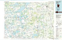
Editions of this 1986 Battle Lake Map
2 editions found
Other maps of this area

1910 · Wendell
USGS Topo · 1:62,500

1911 · Barrett
USGS Topo · 1:62,500

1911 · Herman
USGS Topo · 1:62,500

1912 · Vergas
USGS Topo · 1:62,500

1912 · Battle Lake
USGS Topo · 1:62,500

1913 · Ashby
USGS Topo · 1:62,500

1913 · Fergus Falls
USGS Topo · 1:62,500

1913 · Wendell
USGS Topo · 1:62,500

1914 · Battle Lake
USGS Topo · 1:62,500

1914 · Pelican Rapids
USGS Topo · 1:62,500