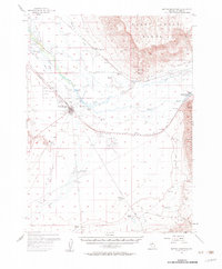
1957 Map of Battle Mountain
USGS Topo · Published 1959About this map
The Humboldt River corridor dominates this mid-century survey of Lander County, Nevada, where the historic California Trail runs parallel to the twin steel of the Southern Pacific and Western Pacific railroads. The town of Battle Mountain serves as the central hub, adjacent to the Battle Mountain Indian Colony and the local Cem. This landscape reveals a high-desert ranching and transit economy, with family-named holdings like Licking Ranch, Blossom Ranch, and Welch Ranch scattered across the flats.
Find a feature on this map
48 named features on this map. Tap any name to fly to it.
Don’t see what you’re looking for? This feature index may not catch every label — zoom into the map to look around manually.
Map Details
Editions of this 1957 Battle Mountain Map
3 editions found

Other maps of this area

1932 · Sonoma Range
USGS Topo · 1:250,000

1939 · Sonoma Range
USGS Topo · 1:250,000

1940 · Antler Peak
USGS Topo · 1:62,500

1943 · Antler Peak
USGS Topo · 1:62,500

1949 · Crescent Valley
USGS Topo · 1:62,500

1949 · Mt. Lewis
USGS Topo · 1:62,500

1950 · Mt. Lewis
USGS Topo · 1:62,500

1950 · Crescent Valley
USGS Topo · 1:62,500

1955 · Winnemucca
USGS Topo · 1:250,000

1957 · Dunphy
USGS Topo · 1:62,500