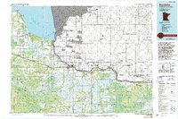
1976 Map of Baudette
USGS Topo · Published 1993About this map
The Rainy River defines the international border on this northern Minnesota sheet, separating the United States from Canada as it flows toward Lake of the Woods. The village of Baudette serves as a focal point for the region, where the Baudette River joins the larger international waterway. The landscape is a mosaic of massive protected areas, including the Beltrami Island State Forest, Pine Island State Forest, and the northern edge of the Red Lake Indian Reservation.
Find a feature on this map
43 named features on this map. Tap any name to fly to it.
Don’t see what you’re looking for? This feature index may not catch every label — zoom into the map to look around manually.
Map Details
Editions of this 1976 Baudette Map
This is the sole edition of this map. No revisions or reprints were ever made.
Other maps of this area

1918 · Buffalo Bay
USGS Topo · 1:62,500

1918 · Winterroad
USGS Topo · 1:62,500

1918 · Roosevelt
USGS Topo · 1:62,500

1918 · F
USGS Topo · 1:62,500

1918 · Williams
USGS Topo · 1:62,500

1919 · Peppermint Creek
USGS Topo · 1:62,500

1919 · G
USGS Topo · 1:62,500

1919 · Canada
USGS Topo · 1:62,500

1919 · Birchdale
USGS Topo · 1:62,500

1919 · I
USGS Topo · 1:62,500