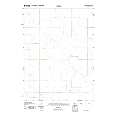
2010 Map of Baxter SE
USGS Topo · Published 2010About this map
North Skunk River meanders across this rural section of Jasper County, defining a landscape of agricultural tradition and small-town connections. The township grid is well-established by the early 21st century, punctuated by a series of burial grounds that mark the heritage of the local community. These sites, including Saint Johns Cemetery and Zoar Cemetery near the intersection of Cedar Ave E and E 20th St N, provide critical anchor points for family historians and genealogists.
Find a feature on this map
47 named features on this map. Tap any name to fly to it.
Don’t see what you’re looking for? This feature index may not catch every label — zoom into the map to look around manually.
Map Details
Editions of this 2010 Baxter SE Map
This is the sole edition of this map. No revisions or reprints were ever made.
Other maps of this area

1954 · Des Moines
USGS Topo · 1:250,000

1956 · Des Moines
USGS Topo · 1:250,000

1957 · Des Moines
USGS Topo · 1:250,000

1965 · Newton
USGS Topo · 1:24,000

1965 · Colfax
USGS Topo · 1:24,000

1969 · Des Moines
USGS Topo · 1:250,000

1975 · Rhodes
USGS Topo · 1:24,000
1975 · Baxter
USGS Topo · 1:24,000
1975 · Melbourne
USGS Topo · 1:24,000

1975 · Baxter SE
USGS Topo · 1:24,000