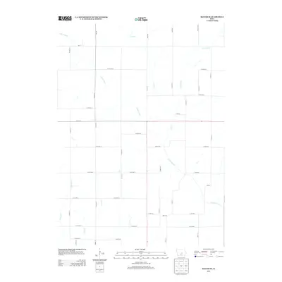
2013 Map of Baxter SE
USGS Topo · Published 2013About this map
The N Skunk River meanders across this rural section of Jasper County, defining the drainage patterns for a landscape dominated by agricultural road grids. The river is joined by several tributaries including Snipe Cr and Little Snipe Cr to the north, while Cherry Cr and E Grand Cr drain the southwestern portions of the quadrangle. This 2013 survey illustrates the modern persistence of the township's rectilinear property lines, established by a network of local roads such as Hart Ave and Lafayette Ave. Major county thoroughfares like Co Hwy S62 and Co Hwy F17 provide the primary transit corridors through Independence Township, connecting the farmsteads and rural homesites that characterize this part of central Iowa.
Find a feature on this map
45 named features on this map. Tap any name to fly to it.
Don’t see what you’re looking for? This feature index may not catch every label — zoom into the map to look around manually.
Map Details
Editions of this 2013 Baxter SE Map
This is the sole edition of this map. No revisions or reprints were ever made.
Other maps of this area

1954 · Des Moines
USGS Topo · 1:250,000

1956 · Des Moines
USGS Topo · 1:250,000

1957 · Des Moines
USGS Topo · 1:250,000

1965 · Newton
USGS Topo · 1:24,000

1965 · Colfax
USGS Topo · 1:24,000

1969 · Des Moines
USGS Topo · 1:250,000

1975 · Rhodes
USGS Topo · 1:24,000
1975 · Baxter
USGS Topo · 1:24,000
1975 · Melbourne
USGS Topo · 1:24,000

1975 · Baxter SE
USGS Topo · 1:24,000