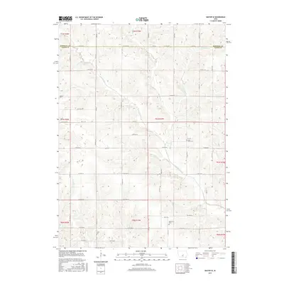
2015 Map of Baxter SE
USGS Topo · Published 2015About this map
The North Skunk River and its upper reach, the N Skunk River, carve a winding path through this central Iowa landscape, defining the topography south of the Marshall County line. The map reveals a deeply established rural cemetery network that serves as a vital record for local genealogy, including Zoar Cem, Bethany Cem, and the Wittenberg Cem near Holly Ave. Smaller watercourses like Snipe Cr and Cherry Cr drain the agricultural uplands, which are organized by a dense grid of county roads such as Co Hwy F17 W. These survey lines and the placement of Linder Cem reflect the systematic mid-19th-century settlement patterns of Jasper County, where family burials and small community churches like Saint Johns Cem remained the primary landmarks long after the initial frontier period.
Find a feature on this map
44 named features on this map. Tap any name to fly to it.
Don’t see what you’re looking for? This feature index may not catch every label — zoom into the map to look around manually.
Map Details
Editions of this 2015 Baxter SE Map
This is the sole edition of this map. No revisions or reprints were ever made.
Other maps of this area

1954 · Des Moines
USGS Topo · 1:250,000

1956 · Des Moines
USGS Topo · 1:250,000

1957 · Des Moines
USGS Topo · 1:250,000

1965 · Newton
USGS Topo · 1:24,000

1965 · Colfax
USGS Topo · 1:24,000

1969 · Des Moines
USGS Topo · 1:250,000

1975 · Rhodes
USGS Topo · 1:24,000
1975 · Baxter
USGS Topo · 1:24,000
1975 · Melbourne
USGS Topo · 1:24,000

1975 · Baxter SE
USGS Topo · 1:24,000