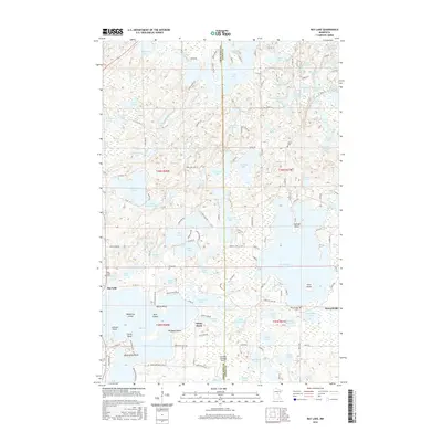
2016 Map of Bay Lake
USGS Topo · Published 2016About this map
Bay Lake dominates this central Minnesota landscape, its complex shoreline defined by prominent features like Brighton Point, Battle Point, and Eaglewood Point. The map illustrates a region defined by its dense concentration of water bodies, where large basins like Farm Island Lake and Tame Fish Lake sit alongside smaller, curiously named ponds such as Black Shadow Lake and Brennen Lake. The area's settlement pattern is largely tied to these waters, with clusters at Bennettsville and the community of Bay Lake.
Find a feature on this map
130 named features on this map. Tap any name to fly to it.
Don’t see what you’re looking for? This feature index may not catch every label — zoom into the map to look around manually.
Map Details
Editions of this 2016 Bay Lake Map
This is the sole edition of this map. No revisions or reprints were ever made.
Other maps of this area

1912 · Deerwood
USGS Topo · 1:62,500

1913 · Cuyuna
USGS Topo · 1:62,500

1914 · Deerwood
USGS Topo · 1:62,500

1914 · Aitkin
USGS Topo · 1:62,500

1915 · Aitkin
USGS Topo · 1:62,500

1915 · Cuyuna
USGS Topo · 1:62,500

1916 · Wealthwood
USGS Topo · 1:62,500

1953 · Duluth
USGS Topo · 1:250,000

1958 · Duluth
USGS Topo · 1:250,000

1973 · Iron Hub
USGS Topo · 1:24,000