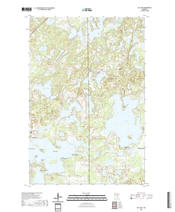
2022 Map of Bay Lake
USGS Topo · Published 2022About this map
Bay Lake and its many peninsulas dominate the southwestern portion of this map, reflecting the complex glacial hydrography of central Minnesota. The landscape is a dense network of water bodies, where larger basins like Cedar Lake and Farm Island Lake are interspersed with smaller named features such as Dogfish Lake, Ringhand Lake, and Snoosebox Lake. These waters are separated by low ridges and points, including named landmarks like Battle Point, Indian Point, and Johnson Point.
Find a feature on this map
138 named features on this map. Tap any name to fly to it.
Don’t see what you’re looking for? This feature index may not catch every label — zoom into the map to look around manually.
Map Details
Editions of this 2022 Bay Lake Map
This is the sole edition of this map. No revisions or reprints were ever made.
Other maps of this area

1912 · Deerwood
USGS Topo · 1:62,500

1913 · Cuyuna
USGS Topo · 1:62,500

1914 · Deerwood
USGS Topo · 1:62,500

1914 · Aitkin
USGS Topo · 1:62,500

1915 · Aitkin
USGS Topo · 1:62,500

1915 · Cuyuna
USGS Topo · 1:62,500

1916 · Wealthwood
USGS Topo · 1:62,500

1953 · Duluth
USGS Topo · 1:250,000

1958 · Duluth
USGS Topo · 1:250,000

1973 · Iron Hub
USGS Topo · 1:24,000