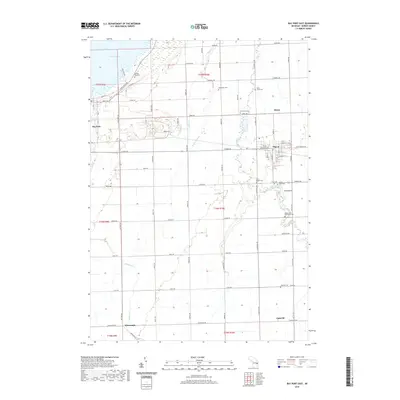
2019 Map of Bay Port East
USGS Topo · Published 2019About this map
Pigeon and Bay Port anchor this Huron County landscape, where the fertile plains of the Michigan Thumb meet the waters of Wild Fowl Bay. The area's deep-rooted agricultural and community history is visible through a high density of rural burial grounds, including the Old Bay Port Cem, Saint Johns Cem, and the Memorial Cem. The winding course of the Pigeon River and Shebeon Cr defines the drainage of these lowlands, which are crisscrossed by a grid of farm-to-market roads like Pigeon Rd and Geiger Rd. Smaller settlements such as Berne, Kilmanagh, and Linkville highlight the early 21st-century distribution of residential clusters away from the primary town centers. This survey captures the region's reliance on the land, from the shoreline of Lake Huron to the interior homesteads served by the Pigeon River Mennonite Cem and Saint Borgia Cem.
Find a feature on this map
50 named features on this map. Tap any name to fly to it.
Don’t see what you’re looking for? This feature index may not catch every label — zoom into the map to look around manually.
Map Details
Editions of this 2019 Bay Port East Map
This is the sole edition of this map. No revisions or reprints were ever made.
Other maps of this area

1954 · Flint
USGS Topo · 1:250,000

1958 · Flint
USGS Topo · 1:250,000

1963 · Gagetown
USGS Topo · 1:24,000

1963 · Owendale
USGS Topo · 1:24,000

1963 · Sebewaing
USGS Topo · 1:24,000

1970 · Bay Port West
USGS Topo · 1:24,000

1970 · Bay Port East
USGS Topo · 1:24,000

1970 · Caseville
USGS Topo · 1:24,000
1970 · Rush Lake
USGS Topo · 1:24,000

1970 · Sand Point
USGS Topo · 1:24,000